
Dr Jeff Fraser and Darren Paul from Golder discuss the benefits of risk assessing geohazards and the implications for infrastructure.
Hollywood producers know the drama and terror of pitting the awe-inspiring, unstoppable power of the natural world against our human smallness. But the stuff of movies is also the regular fodder of the nightly news. Landslides, earthquakes, volcanoes, tsunamis, and floods are an ongoing feature of human existence.
With the devastating cost of natural disasters to human life, economies, the environment and built infrastructure, investing in resilience is not only an important but urgent need. Building resilient infrastructure protects lives and livelihoods and helps to secure the post-disaster economy. The resilience of infrastructure and its level of exposure to natural hazards is also of increasing interest to the insurance industry because it is reflected in their policy premiums.
Investigating and understanding the natural hazards that could affect new or existing infrastructure is more than strategic; it is essential to assessing and managing societal risk.
Understanding geohazards
The term ‘hazard’ refers to a condition or phenomenon that has the potential to cause harm or an undesirable consequence. When we use the term ‘geohazard’, we’re talking about both natural and human-induced conditions that arise from hydrological, geological and geotechnical processes, such as flooding, tsunami, earthquakes, volcanic eruptions, landslides, sinkholes, sea-level rise and more. (Of course, there are other natural hazards such as wildfires, storms and droughts – but these fall outside our scope here.)
Earthquakes are an example of a natural phenomenon that causes a number of geohazards. Large-magnitude earthquakes generate a strong ground shaking hazard and sometimes are associated with a surface fault rupture hazard that displaces and deforms the ground surface. The strong ground shaking hazard causes a range of other geohazards such as soil liquefaction, seiches in lakes, ponds and even swimming pools, landslides and damage to buildings and other structures. To describe the earthquake hazard, one must understand the earthquake shaking intensity, types of phenomena it generates, and the effects in the area of interest.
READ RELATED
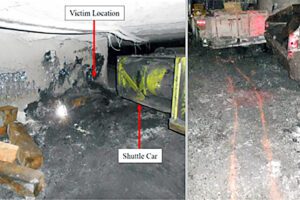
Dangerous Incident: Coal Burst
Geohazards can be characterised in many ways, but generally the characterisation process starts with a geohazard screening exercise to identify the hazards that may affect a site, an understanding of the hazard information needed to understand better the likelihood and intensity of the geohazards.
Understanding geohazards relies on the expertise of a number of professions; however, identifying geohazards is a speciality of engineering geologists. More detailed studies of particular hazards may be undertaken by other professions such as geotechnical engineers, geophysicists, seismologists, and hydrologists.
Assessing and managing risk from geohazards
From an engineering perspective, there are two pertinent, but different, definitions of risk:
- Risk is the combination of the likelihood of a hazard with the consequence of the hazard. The consequences may be economic, environmental, reputational or risks to life.
- Risk is the effect of uncertainty on objectives.
These two definitions can be combined to describe engineering risk as the probability of loss based on the understanding of the likelihood and consequences of a hazard or many hazards.
Owners or developers of infrastructure with a high value or high consequence of failure need risk management plans that involve a qualitative geohazard risk assessment at an early stage in a project – often as part of the feasibility stage. High-value infrastructure includes oil and gas pipelines and associated facilities, nuclear power and associated facilities, large water storage dams, mine waste facilities, ports, airports, and buildings with an important post-disaster function (e.g., hospitals).
The approach to risk management varies across jurisdictions and industries; some projects are more regulated than others in the risk management approach.
Geohazard risk assessment process typically uses a staged approach designed to understand and unravel geohazard risk in both engineering and commercial terms.
The scope of a geohazard risk assessment report may vary, but the key components should include the identification of possible hazards (threats) and a qualitative and/or quantitative risk assessment of each hazard. The report should also pinpoint the different levels of further investigation needed to improve understanding of the geohazard or measures that could be used to reduce the likelihood, consequences and/or their uncertainties.
In some cases, where significant hazards are identified, specialist studies are undertaken to reduce uncertainty surrounding the likelihood and intensity consequences of the hazard as a way to reduce the uncertainty of the consequences. Further, mitigation measures can be designed and analysed to reduce the consequences of the hazard.
After risk reduction or mitigation measures have been investigated and identified, the project owner or developer will usually need some guidance to understand their options and to choose the best path forward for their project.
But this isn’t the end of the road. Risk assessment and management shouldn’t be seen as a one-off, check- the-box exercise. Part of any organisation’s risk management approach should be a continuous improvement model in which risks are regularly reassessed.
Putting theory into practice
To make all of this theoretical discussion of risk assessment and management a little more tangible, let’s consider the example of an emergency services building planned for a small town in New Zealand. To develop this facility, three properties are considered for purchase. A geohazard assessment of each of the three sites is conducted.
One site is at sea level and is susceptible to a tsunami hazard. The second site is near a river and is prone to frequent flooding. The third site is located on 30 metres of loose sand and silt and is exposed to a significant liquefaction hazard from regional earthquakes. Initial analysis shows that the liquefaction hazard can be mitigated on site using engineering ground improvement techniques. This third site is, therefore, chosen and purchased.
What are the next steps?
First, the earthquake loading needs to be quantified so that the structural and geotechnical design team can proceed. Calculating the earthquake loads involves carrying out a cloud-based, probabilistic seismic hazard analysis to understand the earthquake loading at different likelihoods (e.g. annual probability of exceedance in this case) and to understand the uncertainty associated with the load estimates.
Next, the earthquake liquefaction hazard is to be mitigated with engineered ground improvement, so the extent of potential liquefaction needs to be assessed and the ground improvement designed. Geotechnical and geophysical investigations of the local soils for the basis of a geotechnical analysis (seismic ground response analysis) undertaken to understand how the soils may respond in to earthquake shaking. The geotechnical analysis incorporates the uncertainties in soil behaviour, the uncertainty in the earthquake ground motions, and the uncertainty in the performance of the designed ground improvement mitigation. The geotechnical analysis is an iterative process that aims to find a local building code-compliant level of ground improvement at an optimal cost and level of performance.
Lastly, a hydrological study is needed to assess the appropriate floor levels that will avoid flood-water inundation, meet the requirements of local legislation, and meet the operational requirements of the facility.
The emergency services building is built to meet acceptable risk criteria. It is not designed to withstand any natural hazard – nothing is. But the investigation and design takes into consideration the best available understanding of the earthquake and flood hazards including the significant uncertainties associated with where and when an earthquake will happen, to make a building that will meet its post-earthquake operational requirements. As new information comes to light over time, the geohazard risk to the emergency services
building will be reassessed every five years to ensure that it continues to meet its risk-based operation requirements.
Making good decisions
Risk-based decision making is the most informed and defensible basis for your choices and actions and your best path to success. Drawing on an informed understanding of likelihood and consequences, a risk-based decision-making approach can reveal the optimal solution to reduce risk to a level you can accept.
It’s still “your risk” – but with the right support you can better understand and manage it.
Read more Mining Safety News


Add Comment